We remain fully operational. Our teams are working around the clock to ensure your deliveries continue safely.

DOWNLOAD THE APP


Customer Services
Copyright © 2025 Desertcart Holdings Limited
DOWNLOAD THE APP
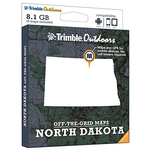
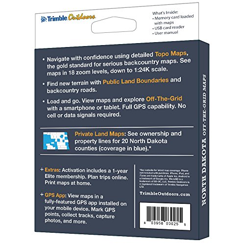

Turn your iPhone, iPad, or Android into a fully featured GPS with North Dakota Off-The-Grid Maps. Get instant access to thousands of full-color topo maps for the entire state. These offline digital maps work off-the-grid, even when you're far from cell phone and data networks. Includes GPS mobile apps designed for hiking, backpacking, hunting, and other outdoor activities. • Map Types Included: Topographic, Forest Roads, Lake Maps, Public Land Boundaries, Private Land Maps • Every memory card comes pre-loaded with an entire state's worth of full-color USGS topo maps, enhanced by MyTopo. • Topo maps feature 18 zoom levels (1:250K to 1:24K) so you can see your GPS location in great detail. See 20-foot contours in most places. • Private Land Maps: See ownership and property lines for these North Dakota counties: Billings, Bowman, Burleigh, Cass, Dunn, Emmons, Golden Valley, Grand Forks, Griggs, Mckenzie, Mclean, Mercer, Morton, Mountrail, Pembina, Ramsey, Richland, Slope, Wells, Williams. • Maps work off-the-grid. No cell towers required. • Works with iPhone, iPad, and Android devices. Android: Place microSD card into device. iPhone/iPad: Drag files from SD card into iTunes. Sync device. • Supported App: Trimble Outdoors (iPhone, Android, iPad). • Supported Website: TrimbleOutdoors.com.
Trustpilot
2 days ago
2 months ago
3 weeks ago
3 days ago