We remain fully operational. Our teams are working around the clock to ensure your deliveries continue safely.

DOWNLOAD THE APP


Customer Services
Copyright © 2025 Desertcart Holdings Limited
DOWNLOAD THE APP
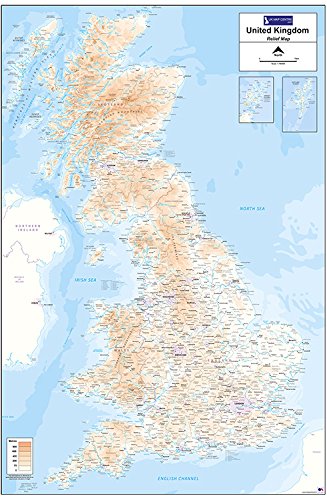
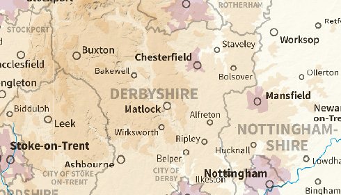
Material Type:Flat - Double Side Laminated The Relief Map 1 utilises 1:780,000 scale Ordnance Survey mapping data to provide a clear and easy to use map of the UK with insets for Orkney and Shetland. An easy to use height key shows land height above sea-level across the country. Also noted are national boundaries for England, Scotland and Wales, as well as county boundaries for these areas. The map measures 900mm (width) by 1300mm (height). This version of the Relief Map 1 UK is printed on 100gsm Matt Paper and is Laminated front and back to provide a long-lasting finish to the map. This map is supplied in a tough reusable plastic poster tube.
Trustpilot
1 day ago
2 months ago
4 days ago
2 months ago