

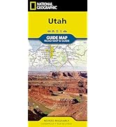
Utah: Guide Maps (National Geographic Guide Map)
Product ID: 560775133
Desertcart purchases this item on your behalf and handles shipping, customs, and support to Israel.
• Waterproof • Tear-Resistant • Travel Map National Geographic's Utah Guide Map is designed to meet the needs of all travelers with by combining a detailed and accurate road map with and an expertly researched travel guide. Find your destination quickly using the user friendly index of cities and towns. Then plan your route on the comprehensive road map, complete with road designations, mileage markers and pinpointed national and state parks, national forests, campsites, ski areas, hospitals, airports and other points of interest. Inset maps of Ogden, Logan, Salt Lake City, Provo provide additional detail of these popular cities. While inset maps and travel information are given for Utah 12 Scenic Byway and Zion, Arches and Bryce Canyon National Parks. An overview of popular points of interest, a calendar of events and a national park service chart are all provided along with relevant contact information. Every State Guide Map is printed on durable synthetic paper, making them waterproof, tear-resistant and tough — capable of withstanding the rigors of any kind of travel. Map Scale = 1:1,314,000 Sheet Size = 17.75" x 24.75" Folded Size = 4" x 8.75" Review: Oh No… I have NO CELL SERVICE - We were visiting Utah’s National Parks. Realized 2 things: 1) if you lose cell service and stop at a scenic overlook, your phone doesn’t always store the map you were using! This map was incredibly helpful. It also helps us find the most scenic routes to travel! Also, 2) we discovered we were traveling on a FREE Nat’l parks day… no thanks crowds! This map was a TERRIFIC REFERENCE for Utah’s AWESOME State Parks! It introduced us to Kodachrome SP, Escalante Petrified Forest SP, Devils Garden and Goblin Valley SP. Also loved the St. George inset. Thanks! Review: nice map with lots of information - Very nice map and information. The scale is surprising.







| Customer Reviews | 4.7 out of 5 stars 643 Reviews |
C**1
Oh No… I have NO CELL SERVICE
We were visiting Utah’s National Parks. Realized 2 things: 1) if you lose cell service and stop at a scenic overlook, your phone doesn’t always store the map you were using! This map was incredibly helpful. It also helps us find the most scenic routes to travel! Also, 2) we discovered we were traveling on a FREE Nat’l parks day… no thanks crowds! This map was a TERRIFIC REFERENCE for Utah’s AWESOME State Parks! It introduced us to Kodachrome SP, Escalante Petrified Forest SP, Devils Garden and Goblin Valley SP. Also loved the St. George inset. Thanks!
P**E
nice map with lots of information
Very nice map and information. The scale is surprising.
A**S
Happy to have a map
Perfect for our summer trip. Good size and easy to fold back up.
K**R
This map survives the trip
This is a great durable folding map. The details are great. The material is great.
A**R
Makes travel more enjoyable for me!
This AP of Utah was very handy during my trip to Utah. I used mapping apps as well. I like being able to see the big picture!!
Trustpilot
5 days ago
2 months ago