Historic Pictoricmap Rome Eastern Hemisphere Map Of The Roman Empire | Desertcart Israel
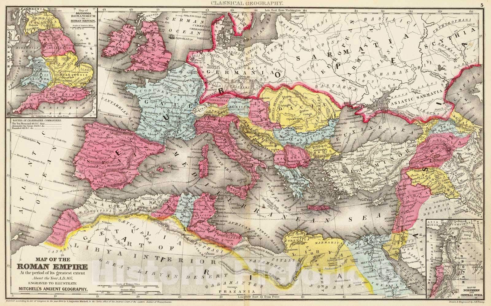
Historic PictoricMap : Rome, Eastern Hemisphere Map of the Roman Empire at the period of its greatest extent about the year A.D. 107, 1875 Classical Atlas, Antique Vintage Reproduction : 44in x 28in
4.4/5
Product ID: 209731540
Secure Transaction
Frequently Bought Together
Description
Historic PictoricMap : Rome, Eastern Hemisphere Map of the Roman Empire at the period of its greatest extent about the year A.D. 107, 1875 Classical Atlas, Antique Vintage Reproduction : 44in x 28in
Common Questions
Trustpilot
TrustScore 4.5 | 7,300+ reviews
Khalid Z.
Great experience from order to delivery. Highly recommended!
1 week ago
Meera L.
Smooth transaction and product arrived in perfect condition.