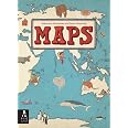

Maps


D**2
Not A Conventional World Atlas ...
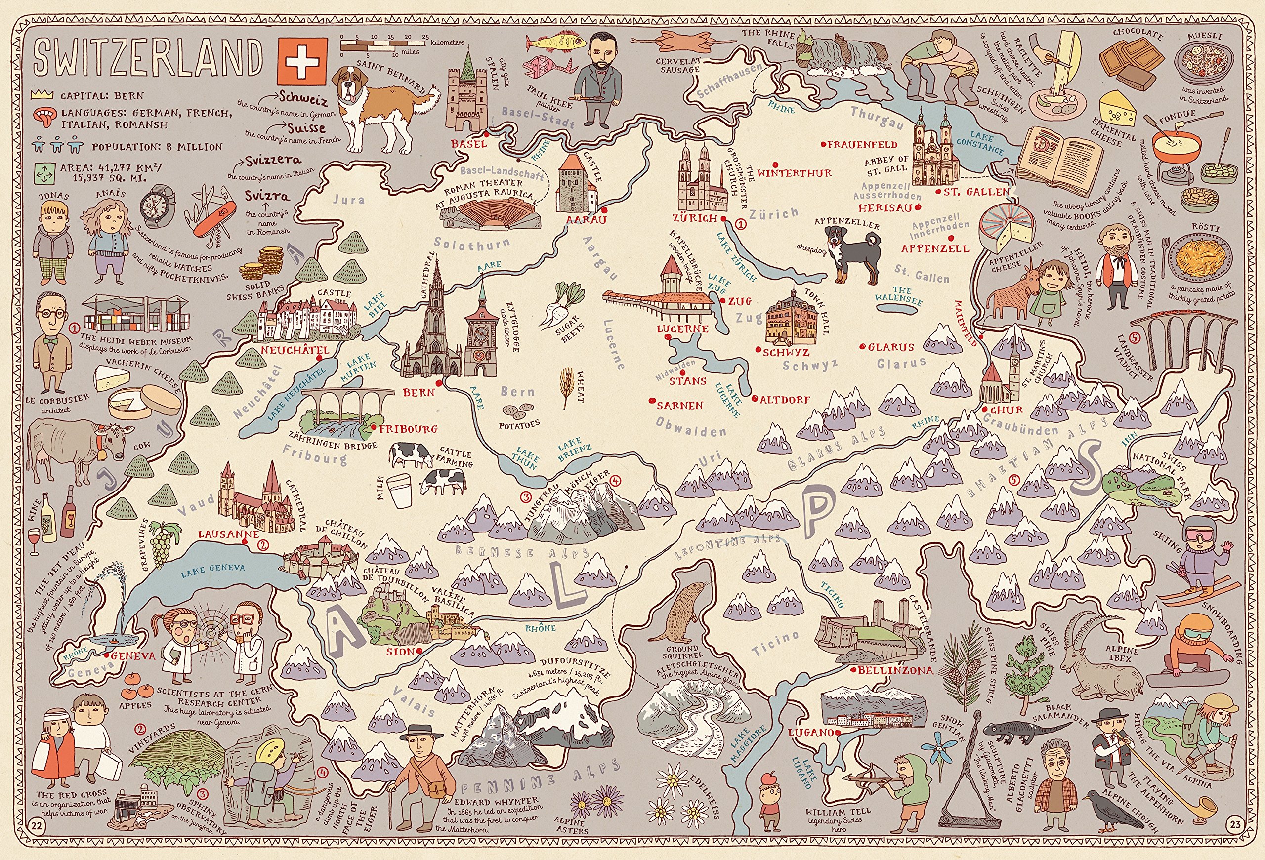
"Maps" by Alexsandra and Daniel Mizielinska is not a comprehensive world atlas. It does not provide detailed topography; elevations; population of cities indicated by font size; or other conventional and expected information. However, what "Maps" does provide is a wealth of trivia and enough information to pique the reader's interest in learning more about each of the selected 42 countries, the Arctic and the Antarctic.Printed on heavy paper stock that is parchment-like in appearance, the illustrations and style of "Maps" are reminiscent of vintage maps. Illustrations are cartoon-like and plentiful. Some may find the maps "busy".Information for each entry includes a picture of the country's flag; the name of the capital city; the official language; the population; and the land mass' area. Cities are shown in red. Other information included about each country includes animal species found in the specific country; points of interest; foods; cultural information; some geographic features. All information is brief and serves only as a "teaser" inviting the reader to explore the country further.Readers seeking a comprehensive atlas that includes information about every country in the world may be disappointed in "Maps". It is not a geography book seeking to be all things to all readers. Individuals seeking an unusual, quality book that may encourage children and adults alike to research the included countries further will find "Maps" a delightful book and one that is well worth purchasing.
E**A
Love it
The book is bigger than I expected, love the art and its easy to follow. My 5 years old boy that it has been obsessed with maps love it .
K**D
Delightful illustrations - great introduction to geography and cultural awareness
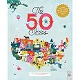
I chose this book for my first grade daughter in honor of her grandma, a retired geographer, at a school book fair. I didn't have time to do more than glance through the book, but loved the illustrations at first sight. In looking at it more closely after giving it to her as a birthday present, I was startled at first when Norway (home of one set of her great-grandparents) wasn't included. I see other reviewers have commented similarly.While it would be wonderful to have all 200-ish countries of the world included, this already-large book would become an unwieldy behemoth. As it is, countries from six continents are included, and provide an engaging, informative experience to encourage children (and adults!) to learn more about the social, historical, cultural and physical geography of the world around them. It can be a starting place to imagine one's own maps of countries, towns, cities, and other places which aren't included in "Maps".To adapt Dr. Seuss's famous quote, don't be sad that many countries are missing, be glad for the ones that are included!
D**L
Great illustrations
This is a very large and beautifully illustrated book! My son really enjoys pouring through the pages and reading the little bits of information on every page. It has tiny pictures scattered across each page to show what each area is known for and give insight into cultures of different regions. I would recommend this to anyone who has kids under the age of 10. Older than that would still find it interesting, but I'm not sure they'd get the use out of it like younger children would.
S**D
Beautiful illustrations
This book is almost too pretty to let my kids have!
A**R
This is a rare treat!
There are currently two negative reviews about this book, which after receiving it, I would like to comment on. Both individuals were upset a country they love was left out. Ireland and Israel aren't in this book, but neither are Norway, Portugal, Denmark, Latvia, Lithuania, Estonia, Ukraine, Turkey and several other European countries, along with every central American country, all nations in the Caribbean, the Philippines, South and North Korea, Indonesia, most of Africa and many others I'm not going to list. Indeed, there are only 52 maps in this book, which was never billed as a COMPLETE atlas. Instead, it's a gorgeous introduction for children (and adults) to pique enough interest to inspire them to learn more about the world. It's funny to me that the absence of both Ireland and Israel were highlighted in the reviews, since both countries have an entire book devoted to them by Sasek. To me, Maps is a great addition to learn more about culture and geography in conjunction with Sasek's amazing This is...series. Furthermore, Israel's capitol in Maps is listed as Jerusalem, which not even the Obama administration recognizes, so I'm still confused as to why one of the reviewers is so angry. Finally, Maps is printed in Poland! I'm getting very tired of Chinese made books, so this means a great deal to me.
S**R
Size
This book is huge - lots of detailed art!My only complaint is that I wish it laid flat when open... It would create a much more child-friendly experience especially since, due to its size, it needs to be laid on a table.
H**O
Beautiful map book, great for all ages.
I first saw this map book in a specialty store in Austria and spent a good 20 minutes flipping through its pages, admiring it. I wanted so badly to buy it but I didn't have room in my suitcase to take it home (this is a large book). Luckily, when I returned home, I found it on Amazon, and it now has a place of honor on my coffee table.Technically, I think it is meant to be a children's book, but aside from some of the whimsical imagery, I think this book can serve as a tool for all ages. I am 23 and have traveled extensively, but every time I flip through this I learn something new. I especially love that it includes more unique things about each of the countries and includes the most popular names for each country.I would recommend buying this for anyone who loves maps and travel, of any age. I don't think I would buy this for a child younger than 5 or six. Keep in mind that a lot of the text is in cursive, so if your children can't read cursive, they may struggle to understand parts of it.
Trustpilot
1 day ago
2 weeks ago