Deliver to Israel
IFor best experience Get the App
معلومات عنا
دعم العملاء
احصل على التطبيق

قم بتوجيه الكاميرا لتنزيل التطبيق
حقوق الطبع والنشر © 2024 Desertcart Holdings Limited
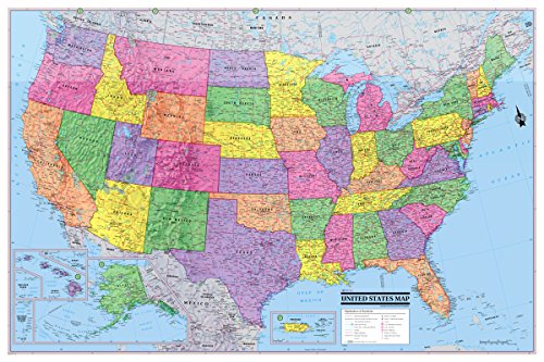


These economical 2016 Political USA/United States poster maps are made by all digital cartography and have color-banded borders for states for easy recognition. Features a wealth of information including state boundaries as well as capitals, many major cities and geographical features (the MOST names than any competitor map this size or even larger). Also, shows a major road network. Digital mapping by Cartographers with many years of mapping experience. They come factory folded for easy use and storage. Ships in an envelope.
ترست بايلوت
منذ شهر
منذ 3 أيام